(Trip planning notes.)
A total of 13 people were involved with the weekend, with only two (Peter Miller and Paul Glass) there for all four days.
I'd like to mention that throughout this entire process, both planning and execution, NPWS has been helpful beyond my expectations. We had many hours of Paul Glass' time; he helped setup and takedown the camp, he helped map squares of blackberry, he helped map creek lines, and all of this in and around his regular Ranger duties. Thank you. The huge NPWS roof, used as a communal tent, helped as well.
The threat of rain hung over the trip for some time. In the event, it rained Thursday and Friday nights, but was largely unimportant in getting the job done. Perhaps we would have more volunteers had they known it would be so pleasant, and perhaps not.
The mapping got off to a slow start. Thursday was about setting up camp, and listening to Danny, the very knowledgeable Bush Regen consultant brought in by NPWS for the day. Danny was most supportive of the mapping effort, and stated that our Number Two Weed is the wretched Moth Vine. Friday saw us with two teams out mapping (15 squares), while on Saturday we had four teams (plus 57 squares = 72) and Sunday we had three teams (plus 11 squares = 83 squares total, or 20.75ha).
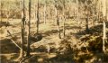
The spraying done in autumn by NPWS is very evident within the crater, with some amazingly large areas reached. However, as you will see with the maps, below, there is blackberry regrowth everywhere. A continuing programme will be necessary.
A mapping grid was overlaid on the Crater, and each square named with a simple two-letter name, e.g. “FG”. Each of these two-letter names were used to name waypoints, one for the centre of each mapping square. Using computer software, very accurate way points files were produced, and loaded into GPS units (GPX, KML).
In the case where the GPS units (or their software) were of such a vintage that waypoints could not be loaded digitally, they were entered manually, as needed, with two double-checks using a buddy system, to ensure accurate data entry.
 Mappers were provided with an A4 page containing the enlarged topo of
the Crater, overlayed with the mapping grid, with each square labeled.
This was to be drawn upon with the results of the mappers' observations,
using the notations indicated to the right.
Mappers were provided with an A4 page containing the enlarged topo of
the Crater, overlayed with the mapping grid, with each square labeled.
This was to be drawn upon with the results of the mappers' observations,
using the notations indicated to the right.
Mappers were usually dispatched in pairs. Upon reaching the centre of a square, as indicated by the GPS Goto function, one of the pair remained in the centre, acting as scribe, while the other walked a 20m circle around them (the GPS Goto function can help here, too, because it indicates a distance as well as a direction). The purpose of this circle is to guesstimate the four 25×25m quarters of the mapping square, and the contents (live, dead, clear) of each quarter. Using MGRS location display on the GPS means that no guessing is required, and it becomes possible to get down to 16th squares, when warranted.
Mapping using the same technique is possible for a solo mapper, and was done in some cases. The advantage of a pair is they can consult each other about GPS issues, navigation issues, and general safety.
As each day progressed, results returned by mapping teams were entered into the laptop, and new maps printed, updated with the mapping results so-far. This allowed teams to see how they were contributing to the overall scheme of things, and why they were being dispatched to various places.
Volunteers were also provided with exemplars of
Participants were then given two mapping square names (close by the camp site) to map, in pairs, changing roles for each square. Any questions could be answered quickly, and the teams rapidly developed confidence in the method, and were dispatched to more distant unmapped squares.
I have yet to transcribe the track mapping onto the map, to place the track to the dam in the correct position (not identical to 1963 route).
We were unable to complete mapping the outlines of the sprayed areas, volunteers may complete that in the comming months.
In the maps below, the results are draped over the topo map, and also the 1963 walker's map, using transparency to permit the map details to show through, permitting navigation within the crater.
Given a square with both “live” and “sprayed” mappers were instructed to mark the square as “live”.
The red area shown corresponds to 7.29ha, although this is probably a smidge high, as the boundary is not as definite as shown here.
| Mapping Grid | Topographic Map | Blue Labyrinth 1963 | |
|---|---|---|---|
| The mapping grid consists of 50m squares aligned on MGRS. Within the squares, quarters are guesstimated. The red area shown corresponds to 7.29ha. |
This fragment is from the Penrith 1:25k topographic map.
It does not have all of the creek lines actually present,
probably because it was prepared from aerial photography,
and some creek lines are (were) entirely beneath tree cover.
| This fragment is from the 1963 walking map, which in turn was probably based on Harry Waite's 1949 map, drawn entirely from ground surveys. | |
|
Blackberry:
The distribution of blackberry. |

|
 (large 1.6MB) |
 (large 82kB) |
The blackberry growth in the north-east saddle is of grave concern.
Try opening this link in Goodle Earth for a 3D view. Note that (1) the Digital Elevation Model that GE is using appears to be out by 50m north-south, and (2) the grid is in MGRS and GE uses lat/long, so the overlay is rotated ever-so-slightly anti-clockwise.
The previous maps are available for comparison.
The mappers are happier, and while (given an infinite suply of GPS units) twice as many solo teams could theoretically be dispatched, the varying levels of experience and confidence meant that this would not have happened. In any event, we only rarely had a suplus of even one GPS unit.
Teams were given A4 map enlargemnts on which to draw their findings. When these enlargements also included progress-to-date this allowed the teams to “buy into” the process, and make informed judgements about extending their missions in approriate directions (i.e. “green all the way around”).